Reizen naar het Wereldkampioenschap
Gepubliceerd op 27 april 2008 00:00
(54 keer bekeken) 0![]()
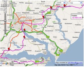
De organisatie van het WK heeft een Gpx file voor gebruikers van een gps apparaat gemaakt voor de aanreis vanaf de boot in Harwich naar het evenemententerrein.
For people who want the coordinates of the field, these are 52.12069 north
1.43654 east (see the .kml file in Google Earth).
Note that there is also a guided cycle route via the ferry to Felixstowe which shortens the way.
Only the route from Harwich via Ipswich has actually been ridden; the others were created from Tracklogs mapping software.
Please note that while using the A14 road to cross the river Orwell may *look* like a better route than going
through the centre of Ipswich, it is *not* - the A14 being a very busy road, with lots of fast, heavy traffic. I certainly would not want to cycle along it, even for a little way.
The route via Felixstowe requires the cross-harbour ferry, which may or may not sail at times suitable for
the riders. This is the route that will be used on Friday evening, when someone will come to Harwich to act as a
guide.


Reacties (0)